by
Keith Lancaster
Note: The reports have been scanned in as written. I have included the height and distance indications, e.g.:
(1000'- 12m.- 4.45p.m.)
which read as follows: height in feet - miles for the day - time.
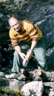
Keith in the Franklands
Utilising the Tasmanian Aero Club, we were flown from Launceston at 8.50 a.m. by pilot Reg. Munro on Feb. 13th. 1960. A clear sky gave some good views and it was most absorbing trying to identify everything that presented itself. We landed on Lake Pedder's beach, left the packs and Wally behind, and took off again to make the airdrops. The first bag was dropped on the old air strip at Junction Creek and the other two bags were dropped high on Goon Moor, but unfortunately from too great a height for full satisfaction. We were back at Pedder's beach at 11.35 a.m. and the plane departed.
Gathering up our capacious rucksacks, we set off southwards along the beach to the S.E. corner of the lake where we lunched at the first creek (1 m. 900'). At 1.20 p.m. we set off around the southern shore of the lake, planning to reach a campsite close under The Lion in preparation for an ascent into the Central Franklands on the morrow. Adopting the popular course of swinging away from the lake towards its western end and later keeping up close to the foothills of the Central Franklands, we crossed the beginning of the ascent ridge to The Lion and swung into the valley between The Lion and The Dome, seeking a suitable campsite well up Timber Creek. Regrowth and overgrown button grass is limiting the once abundant sites in the area, but at length we were satisfied with a choice well up the gully on the east side of the creek (1200' - 8m. - 5.50 p.m.).
Cloud had increased during the afternoon and rain began to fall as we retired, continuing steadily until midnight and intermittently thereafter. Sunday's breakfast was taken inside the tent, and the morning advanced with some clear intervals and breaks in the clouds. After lunch, Wally and I left at 2 p.m. to explore the route to The Dome from the ridge to our west, as the weather was insufficiently stable to suggest shifting camp. We crossed Timber Creek through some scrub and clambered up to the button grassed ridge crest, following it up to the top of the first shoulder (1m. - 3 p.m.). We continued upwards along a windy crest mainly on B.G. until we were halted by a good mile of solid scrub which barred the way right to the base of The Dome (2350' - 2m. - 4p.m.). Rain was also falling again and we did not relish pushing into the wet scrub, especially as it was impossible to complete the full ascent in daylight.
Thus we turned back at 4.20 p.m., following the ridge down almost to its base before crossing Timber Creek, where the neck of scrub was much narrower, and returning to camp (1200' - 4m. - 5.40 p.m.). The remainder of the afternoon continued showery and we retired at 8.45 p.m., hoping for an improvement on the morrow.
After heavy rain all night, Monday showed even less promise. Again we were obliged to breakfast inside the tent as the rain continued incessantly to late in the morning. We had a short stroll to the edge of the ridge before lunch, but it wasn't until late afternoon that any real improvement in the weather began. We retired hopefully at 10 p.m. The clouds were fairly broken and rain had been absent for a few hours.
Tuesday dawned fine and calm with broken cloud and we were up early and away at 7.55 a.m. Pushing up to the crest of the climbing ridge (¼m. - 8.25 a.m.), we followed it upwards, stopping now and again for a photograph and taking a spell after bridging the first rocky outcrop above (2200' - 2m. - 9.25-35 a.m.). The way then became rather erratic (sometimes over the top and sometimes around the eastern edge of the rocky outcrops), but wombat pads and the footprints of others showed useful leads. Finally came the long climb up the main rocky massif to reach the cairned summit of The Lion (3200' - 3½m. - 11.10 a.m.).
It was very misty on top with low, moving clouds, although the sky seemed quite clear to the north. Only the immediate surroundings were visible and all looked very rugged.
| We made a magnetic check of what showed out as follows: The Dome 310 deg., Coronation Peak 301, Double Peak 288, Lion Junction Peak 253, high peak immediately to east 228, high curved summit about 3 m. away 198, two Citadel peaks 145 and 129, The Bluff 140, Citadel Lake 152-177. |
Resuming at 11.45 a.m., we followed the erratic crest along, keeping on the east side of a razorback for much of the way. After a short descent, we climbed up to a clear saddle which broadened into open grassy plateau at the junction with the main ridge of the range (3000' - 4¼m. - 12.15 p.m.). We had lunch and then explored the area for campsites. Good fine weather sites abounded, even though fuel was short, but a well-sheltered site did not appear. A strong south-westerly was pushing over an abundance of cloud and visibility was not so good. The cloud ceiling hung around 3000', our altitude, and the only clear sky was northward.
We decided to account for the most westerly of our objectives during the afternoon - The Dome, and set off packless at 1.5 p.m. Bypassing the first elevation with a good lead around the northern side, we had an easy walk along the scrub-free main ridge of the Franklands, bypassing the other outcrops on the south, and then swinging down onto a lovely little plain under The Dome. The final Climb was easy and short, eastward to the cairned summit (3220' - 5¾m. - 1.42 p.m.) (Cupola). This was no rocky ragged summit that could be expected from its tall northern and eastern cliffs and the general disposition of quartzite, but a smooth, open, friendly rise that would be a place to linger long on a fine day. However, the mist had thickened as we neared our goal and cold, light, drizzling rain was with us on top.
With almost nothing to see and certainly nothing to induce us to remain, we started back at 2.10 p.m., faithfully retracing our course back to the pack dump (3000' - 7¼m. - 2.45 p.m.). The weather was still rather miserable and we explored the main ridge eastward, climbing over the jagged crest of Lion Junction Peak. Visibility was "only just" and the going rather uneven. With prospects of locating a good camp ahead somewhat doubtful, we chose to return to our pack dump as a rain squall arrived. This caused us to change plans about camping on the high ridge and we decided to withdraw down over the more sheltered northern side. Buffeted by the increasing wind, we descended the steep slope between The Lion and Lion Junction Peak in the direction of Citadel Lake.
A flat shelf to accommodate the tent was slow to materialise but at length we settled for a mediocre one amongst some sparse ti-trees (2600') half a mile down hill. Under rapidly worsening weather, we concentrated upon getting the tent in position after doing a little excavating to strike a level. The tent walls were stayed with heavy logs and every effort was made to lash our shelter down securely. Ample scrub tips were gathered for bedding and at last we were all able to pile into the tent by 6.30 p.m., change into dry clothes and settle into our sleeping bags, gnawing into yet another cold meal.
It was one of the roughest nights I have experienced in the mountains. It was as well our precautions were as elaborate as possible as, during the fury of the storm, the wind would surge in, lift the tent almost bodily and then hurl it down almost on top of us. Any moment it seemed it would come adrift or rip asunder, but the new Willesden triumphed. The rain and wind began to moderate towards morning and daylight came with a low mist, a cold wind and occasional showers.
We managed to get a good fire going, had our breakfast and began drying out our wet clothes. Leaving the tent up and most of our gear behind, we left at 9.45 a.m. to climb The Citadel and return. We entered the thick forest below us within a few minutes and steered a course towards the outflow of Citadel Lake. Crossing the creek fairly close to the lake, we descended through nice open leads to the lake (2500' - ¾m. - 10.15 a.m.). It was a charming spot and excellent campsites abounded.
Exploiting the clear leads, we worked up to the crest of the morainal ridge to the north, following the crest to the base of the northern end of The Citadel. The narrow scrub collar was soon penetrated and we came into the open on The Citadel under the southern wall of the north peak. Rather an interesting rock climb ensued up to the summit, and even the returning drizzle failed to dampen our enthusiasm. In the cairn on top (3000' - ½m. - 11 a.m.) we unearthed a sodden note which verified that B.W. Lock of Sydney, Bondi Wanderers Bush.... and another Jim ...... had visited here on New Year's Day 1954, possibly the first ascent.
The cold misty conditions induced our early departure and back down the south side we clambered and then farther along the ridge to scale the northern wall of the south peak, a slightly easier task (2980' - 2m. - 12 noon). This peak was obviously the lower of the two. Soon we commenced our return, going back to the base of the north peak and then down to the sloping morainal ridge and the lake. The route through the forest started from the same point but was more direct and reasonably good. Arriving back at camp (2600' - 3¼m. - 1.20 p.m.), the weather was a 1ittle better. The sky was still overcast, but the clouds were higher and no rain had fallen for nearly two hours.
We broke camp after dinner at 3 p.m. and chose a direct ascent up The Lion, reaching the ridge top at 3.25 p.m. and the summit cairn (3200' - 4¼m. - 3.55 p.m.). We then descended The Lion down the northern climbing ridge via the course we had used yesterday in ascending. At the base we turned eastward and camped at the first creek, i.e. the one coming from Citadel Lake (1100' - 8m. -6 p.m.). We hastened our camp preparation and cooking as fine rain appeared imminent, but only a light drizzle eventuated during the night.
On Thursday, Feb. 18th. we experienced a calm morning with very low cloud and a moistness in the air. All the peaks along the range were heavily cloud-capped. We broke camp at 9.10 a.m. and picked a fair course back to and around Lake Pedder, lunching at our familiar spot at its S.E. corner (900' - 6m. - 11.50 a.m.). We resumed at 1.50 p.m. in more hopeful vein as the drizzle of the morning had gone. Low clouds were still capping the Franklands but the weather was calmer and warmer despite still little sunshine. We passed through the gap between Mt. Solitary and the Franklands and across the broad plain through which Jones Creek flows. On the far side of the plain, near the base of Mt. Giblin, we dropped our packs (950' - 8½m. - 3.25 p.m.).
After a rest, Wally and I set off at 3.55 p.m. to climb Mt. Giblin - an elongated spreading elevation, more in the formation of a range than a mountain. The highest point lay at 225 deg. mag. and we chose a diagonal ascent up steep but clear walls, keeping up a solid pace as the hour was late. Reaching the crest of the main ridge, we continued westward along the undulating top for nearly a mile before we gained the uncairned summit (2700' - 11½m. - 5.15 p.m.).
The weather had improved further and most peaks to the north were free of cloud. The Denisons, Clear Hi11, The Thumbs, Mt. Wedge, the Fields, High Rocky, parts of Anne, Schnells Ridge, Mt. Weld, Mt. Picton, much of the Franklands and the higher peak to the south across a deep valley all showed clearly. The upper sky was clear and the clouds were mainly low lying. After erecting a cairn, we left at 5.30 p.m. and a further brisk walk took us back to Helen and the packs (950' - 14½m. - 6.30 p.m.). We left again at 6.40 p.m., fully burdened, seeking a satisfactory campsite. We turned S.E. towards the Huon and the Port Davey Track and finally settled for an unpretentious site on the open button grass close to wood and water (900' - 15m. - 7 p.m.). The clouds dropped down into the valleys and the stars came out very brightly. The camp took quite a while to organise and we were rather late in retiring.
It was a lovely morning on Friday. The low clouds rose and evaporated early and the sky was cloudless as we set off at 9.10 a.m. for Junction Creek and the Arthurs. We effected a good dry crossing of Scrubby Creek, the next tributary (2½m. - 10.20 a.m.) and reached the Port Davey Track at 10.45 a.m. We halted along the track for a drink (3½m. - 10.55-11.5 a.m.) as the sun was now becoming very hot. Plodding onward, we encountered a few weak patches on the track and a few somewhat overgrown, and were pleased when the familiar markings of Junction Creek camp were reached (800' - 8½m. - 1.20 p.m.).
We had early plans for climbing the main western peak of the Arthurs (Peak 4), but our late arrival at Junction Creek left us little time and the heat and heavy burdens also had an effect. However, Wally and Helen left camp after lunch at 3 p.m. bound for the peak. After setting up the tent, I started off at 3.25 p.m., taking the Port Davey Track and heading south, losing a little time at the creek crossing due to undergrowth obliterating the track. Thus it wasn't until 4.30 p.m. that I reached the base of the clear climbing ridge from the west. An assessment of the time likely to be taken to complete the climb and return indicated that I was fairly certain to be benighted and probably cause some concern to the party. Accordingly, 1 returned to camp at 5.40 p.m. to find that Helen had returned already after leaving Wally near the base of his direct climbing route.
We carried on with the usual camp chores, including preparations for the night and the evening meal. The clear sky gave us good views of all the surrounding mountains and the camp was in an ideal situation. We met three other bushwalkers who were camping alongside (Mr. and Mrs. Vic. Batchler and Jock Turner) and had quite a happy chat. At 8 p.m. Wally returned at dusk to announce that he had reached the summit of Peak 4 after a steady climb. Then we dined and chatted under a clear, star-filled sky, retiring at 10.55 p.m.
We stirred on Saturday, Feb. 20th. to see a low mist shrouding the plain, but it had evaporated by the time we set off at 9.50 a.m. on our journey farther down the Arthurs. We followed Marsden's Track leading eastward, crossing Two Mile Creek (2m. - 10.35 a.m.), the 3-mile post (11.10 a.m.), Four Mile Creek (4m. - 11.25 a.m.) and, after a 15 min. respite, pushed on to lunch at Seven Mile Creek crossing (850' - 5½m. - 12.20 p.m.). The day was now very warm although the sun was screened with a thin film of high cloud.
Resuming at 1.15 p.m., we crossed a tributary stream (6m. - 1.35 p.m.) and left the track half a mile farther on (1.45 p.m.). We turned off at right angles and closed in on the Arthurs, preparatory to climbing Peak 25. We passed an old campsite and left our packs nearby (900' - 7m. - 2 p.m.). At 2.15 p.m. we set off for the base of the clear climbing ridge. The ridge ascent was steep and the party soon began to spread out. On top of the ridge a couple of alpine lakes showed out in the range. A short level walk brought us to more steep climbing and the sight of yet another lake. Upwards and still upwards with the going quite open, we battled on until at length the exposed summit was gained (3450' - 9½m. - 3.45 p.m.), Mt Scorpio.
The sky was still half clouded but the ceiling too high to obscure any feature of the extensive panorama. An array of peaks and crags showed out along the range, several as nameless as those farther south.
| A quick check with the compass gave the following bearings: Mt. Picton 75, Hartz Mt. 92, Adamsons Peak 106, West Portal 112, Federation Peak 126, Pindars Peak 132, Precipitous Bluff 135, Ironbounds 152, near high peak of Arthurs 172, Norolds (?) 200, Mt. Rugby 211, Mt. Berry 225, highest peak of Western Arthurs 270, Mt. Hayes 278, Peak 4 282, Double Peak 301, Coronation Peak 302, B.K.6 306, Mt. Sprent 310, Lake Pedder 320, Frenchmans Cap 324, Mt. Wedge 340, Clear Hill 342, The Thumbs and Lake Edgar 347, Wylds Craig 349, Mt. Anne 1, Sarah Jane 7 and Snowy Range 29. |
Leaving at 4.25 p.m. we retraced our steps back to our rucksacks (900' - 12m. - 5.23 p.m.) and trudged on eastward, looking for a suitable campsite. We had not long to search as we found a very suitable old campsite on the west bank of the eastern branch of Seven Mile Creek (850' - 12¼m. - 5.30 p.m.). We had everything quite comfortable by dark and retired contentedly at 10 p.m. with the sky fairly clear, the night warm and a bright fire glow in the eastern sky, occasioning us some concern as to whether the whole plain would be burning in the morning.
Another morning mist enshrouded the Arthur Plains as we emerged on Monday, Feb. 21st., but the sun could be seen through it. At 8.10 a.m. we were off eastward, planning to climb West Portal on our way to Federation Peak. We reached Strike Creek (900' - 3½m. - 9.40-50 a.m.) and found the sun extremely hot as we clambered up the rise beyond through tall and knotted button grass. We made a little height but otherwise little progress before we decided to drop packs (1130' - 4m. - 9.40 a.m.).
At 9.50 a.m. we were away packless on the climbing ridge leading up to Peak 29. After a steady climb we reached the crest of the range (2750' - 5½m. - noon) and scrambled down the S.E. ridge to Peak 29a (Lucifer) and then returned and took the S.W. ridge up to the summit of Peak 29 (Andromeda) (3400' - 7½m. - 1.50 p.m.). The surrounding view was good with West Portal to the south the dominant feature. Wally was already well on the way towards that objective, carrying all our food. Encouraging along a reluctant Helen, I followed, but our pace was slow and we didn't reach the top of West Portal to belatedly claim our share of the lunch until mid-afternoon (3750' - -9m. - 2.50 p.m.).
The view was really superb and everything was visible despite some haze and smoke interference.
| Only the more salient features were checked magnetically as time was short; Precipitous Bluff 140, Federation and Pinder Peaks 135, Mts. Hopetoun and Bobs 115, Mt. Picton 61, Mt. Weld 19, Mt. Anne 349, The Thumbs 341, Clear Hill 337, Coronation Peak 302, and highest peak of Western Arthurs 281. |
At 3.25 p.m. we started back along the range crest to Peak 29 and then down the long ridge to reach our packs (1130' - 13m. - 5.45 p.m.). A short snack and we were off at 6 p.m., pushing eastward in search of a campsite. We encountered some thick scrub in crossing the first tiny creek and settled for a camp in the open between the first and second tiny creeks, relatively close together (920' - 13¾m. - 6.35 p.m.). We soon had quite a comfortable camp and lunched heartily beneath a starry sky on that warm evening, retiring at 9.10 p.m.
Monday, Feb. 22nd. provided a few early clouds but it was already hot and sunny when we broke camp at 8.25 a.m. and headed S.E. along the plain. We encountered a little vegetation on the saddle between Strike and Pass Creeks, but recent fires had made the way fairly open. We were then able to swing southwards towards Pass Creek and stopped for a rest at a Pass Creek tributary (900' - 4m. - 10.15-35 a.m.), the one coming from Hopetoun Gorge and not far from its confluence with the main stream.
Resuming at 10.35 a.m., we crossed over to the base of Luckmans Lead, a steep, open ridge leading up into the Eastern Arthurs. It was naturally hard, warm work toiling up the slope and, even when we gained the top of the lead, we were unable to locate the water and had a dry lunch (2030' - 5½m. - 11.45-12.35 p.m.). Following the lightly blazed trail up through the scrub above, we continued upwards at an easier grade and came out onto to some open tops, the "Boiler Plates" (2500' - 6¼m. - 1.5 p.m.). Our climb up the open area of Luckmans Lead had been in hot sunshine with a high degree of humidity, but now conditions were changing with both wind and cloud rapidly increasing. We continued S.E., dropping down a little and then ascending steeply again before falling slightly to Stuart Saddle and then over the eastern side underneath The Needles. We had little difficulty locating the small landslide from which our route swung S.E., but duplication of routes and bad visibility due to low cloud caused us to take the wrong shelf under The Needles, but after losing a little time and additional energy, we came back onto the mountain ridge just south of The Needles, picked up the trail which led through an abundance of scopari over quite a high rise and then wound downhill until it brought us out at the top of Goon Moor. It was raining lightly when we reached the high H.W.C. camp (3250' - 10m. - 6 p.m.), yet we had quite a long search before we discovered water. The low mist made a thorough search for our airdrop rather awkward, so we postponed it, after a reconnaissance, until the morning. We had a late dinner and settled down on a comfortable pandanni mattress at 10.35 p.m. The wind had eased, the clouds weren't so thick, and rain had ceased, but the sky was still overcast.
The weather was still fine in the morning (Tues. Feb. 23rd.) with broken cloud. We made a search for our airdrop but recovered only one of our two bags, although several other bags were still around awaiting collection. We augmented our fond stocks from some supplies left by a Victorian party at the Lower Goon Moor campsite, a far better site than ours. We had then to repack our supplies and didn't set off until 10.10 a.m. Continuing S.E., we passed over a slight rise ahead and followed the ridge along, adhering as closely as possible to the popular blazed route. We traversed around the western base of Four Peaks where we lunched (3450' - 3½m. - 12.15-1.15 p.m.) and located some of that scarce commodity, water, in a gully. After lunch, we continued around Four Peaks through the narrow gully between the final peaks and then along the scrubby ridge to emerge at last in open country at Thwaites plateau (3220' - 6m. - 3.30 p.m.).
We crossed over the open plateau to the eastern escarpment (4.5 p.m.), looking for the forest chute. We had decided on this plan as a break in the weather was imminent, indicated by increasing cloud, and Hanging Lake would be an unsuitable site under rough conditions. We probed around a long time before we ultimately settled for the right course and, even then, we were well under way down the upper section before we were confident we were on course. The way down was steep and slippery, somewhat scrubby in the upper section, but quite open at the base. We pushed beyond to the larger Federation lake, set in a dense rain forest with the tree growth infiltrating well into the water, with neither bank, beach or border visible. A little beyond the lake, we found one of the rare dry patches on which to cut out a campsite (2450' - 9½m. - 5.55 p.m.) and promptly set to work making it habitable for the night. The breeze was increasing, even in our sheltered hollow, and there was high humidity when we retired at 9.30 p.m.
Rain fell overnight and our introduction to Wed., Feb. 24th. was in the form of rough and cloudy weather. We packed up and set off at 8.20 a.m. and, after a little probing, soon located the base of the scree slide, but a short distance from camp. It was anything but a scree slide, just a tumble of large quartzite rocks down which a tiny creek gurgled. It was steep, yet relatively easy climbing, and we were intrigued by the varying colours in the quartzite rocks of this long chute. The higher we climbed, the stronger the wind blew and at last we gained the top of the chute and pushed through the scrub on to the upper Bechervaise plateau (lm. - 9.25 a.m.).
Here we were rudely greeted by a moisture laden gale of intense velocity. We pushed across the sodden plateau and started the erection of our tent, the preliminary move on our attempt to climb Federation Peak. It was soon evident that we were set quite a problem. Despite the increasing rain and wild wind, we erected the tent and supported the guys and poles with huge slabs of quartzite, some as heavy as we could carry. We sheltered inside, but such was the violence of the impending storm that the tent billowed and bulged practically uncontrollable under the fierce impacts and our refuge seemed a high risk indeed.
We crouched inside and talked things over. Our problem was accentuated by the fact that we would have to tackle the peak that day or abandon it as our time was running out fast for we were a little behind schedule. To Wally and Helen, abandonment would be a bitter blow as they hadn't climbed the peak before and had regarded it as the highlight of the trip. Yet I could only leave it to them to decide as, for my part, a return to the peak in bad conditions was no particular attraction, although I felt it would not be unduly hazardous despite the severe conditions. After a long debate, a decision was reached to abandon the climb and it is very possible it was a wise one. Thereupon we pulled down the wet tent and repacked, intent upon getting away down off the mountain before the weather became any worse.
We descended to the lower Bechervaise plateau, an even more exposed and inhospitably desolate place than the upper one, and then started down Moss Ridge along what is almost a track, so different from my visit of 1949. The rain continued, so with the wet bush and the lashing of the wind, we were soon rather wet and cold. The course of the "track" was somewhat difficult for heavily laden users but its directness produced results and we were able to halt at the old Moss Camp for lunch (3m. - noon).
The track has a few false duplications which create confusion and delay in places, but we plugged steadily downward, now well beyond the grip of the howling gale. We had a rest and a short snack at the Cutting Grass Camp (5½m. - 3 p.m.), before crossing the West Craycroft and following it down, clear of the south bank. The "track" seemed non-existent half a mile below and we zigzagged around quite a deal and occasionally struck scrub trouble. At length better going was encountered beyond the Paper Bark Camp and we re-crossed the stream and decided to camp at the 1952 campsite of the V.T.M.C. on the north bank (1400' - 7½m. - 5.55 p.m.).
It was still raining intermittently. We established a comfortable camp, managed to cook a good meal, but were unable to dry out our wet clothes owing to the rain setting in more steadily and we retired, as a result, at 8.15 p.m.
Heavy rain fell during the night and the river had risen quite a deal by morning. We dried out most of our wet things in between showers, but it took quite a while as some sharp showers, including hail, frequently had us scurrying for shelter. We eventually set off at midday and followed the general course clear of the north bank until we came down to effect a crossing about half a mile above the river junction. The swollen stream presented a poser and the crossing was not without thrills and spills, but we managed it and pushed farther down to cross and lunch at the South Craycroft (1000' - 2½m. - 2.15-3 p.m.).
Substantial regrowth now cloaks the slopes of the South Pictons in contrast to my earlier visits. Cautiously, I checked the position of Burgess Bluff at 37 deg. mag. and Wilsmicro Lead at 56 deg. before setting off through the scrub. This was thickest around the Knoll but happily there was a well-broken trail right through it. As the scrub thinned, fallen logs and rocks took over and it was a very tired party that reached the high saddle between Burgess and Anderson Bluffs (3100' - 2½m. - 5.30 p.m.). Fortunately, the clouds were high enough to permit reasonable visibility, so we plodded slowly along the South Pictons around the west of Mt. Chapman and down to Pineapple Flat (2700' - 4¼m. - 6.30 p.m.). We had planned to reach the Low Saddle camp, but the party was becoming very slow and the Flat seemed to offer reasonable facilities. We set up the tent on the pineapple grass but found fire lighting difficult as the old dead pines were wet and decayed and there was no recent dead growth to use. Cooking was a slow business and the evening was rather cold. We retired at 9.50 p.m.
We encountered the same difficulty on the morning of Friday, Feb. 26th. in getting a good fire established, and the weather was not very co-operative. We were under way at 10 a.m., climbing up onto the ridge above in the usual thick mist. Our first problem was to locate the Low Col which runs off the range well down the hillside on the east and links up with the main Picton massif. Ever on the alert for the col, we took the false spur which juts out ¼ mile farther south, but realised our error fairly soon. It was then we found a young dog which joined our party - a rather lonely little waif who was obviously pleased to find human company once again.
A short distance farther north we located the Low Col and crossed over to the campsite (2350' - 1½m. - 11.15 a.m.). We climbed up onto Hewardia Ridge where a thinning in the cloud gave us a better opportunity to find our bearings. We pressed on as best we could, trying to capitalise on the temporary clearing whilst it lasted. We picked up a pair of canvas gloves along the way. Luck was with us as sufficient visibility continued and we were able to drop down from the ridge towards Winking Eye Creek, where we could see a tent erected. When we reached there (2450' - 4m. - 1.20 p.m.), we were just in time to have a word with our companions of Junction Creek before they started off for North Lake. Fortunately we were able to return the gloves we found to its rightful owner. After lunch, we followed suit at 2 p.m. and somehow managed to reach North Lake in front of them (2500' - 5¾m. - 2.55 p.m.). As they planned to camp there, we parted company again at 3.5 p.m., bound for Blake's Hut. We also left the dog with them as they knew the probable owner. We were soon down at Clearwater Creek (2300' - 6½m. - 3.35 p.m.) and then followed the long steady downward hike over a fairly well blazed trail until we reached the shelter of Blake's Hut (480' - 10m. - 5.45 p.m.). Conditions were much more pleasant down at this low altitude and we set happily about cooking, drying out and camping.
The weather was quite promising on our final day and we lingered a while for photography, etc. before we started off at 10.45 a.m. We now had a broad open track to walk along and the remaining miles slipped quietly by and we came out at the end of the Geeveston road, hoping for a lift. There was no transport around so we lunched nearby, then encountered a car owner who was also the dog's owner and he brought us out to Geeveston from where other lifts eventually got us all home.
If
you would like more information on Keith Lancaster's diaries, please feel
free to send me an email.